
Page 24 - HUDCO-BPA21
P. 24
URBAN GOVERNANCE
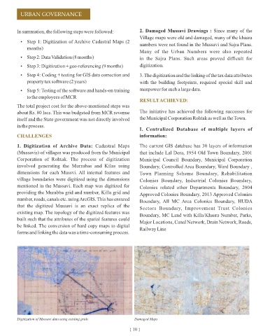
In summation, the following steps were followed: 2. Damaged Mussavi Drawings : Since many of the
Village maps were old and damaged, many of the khasra
Ÿ Step 1: Digitization of Archive Cadastral Maps (2
numbers were not found in the Mussavi and Sajra Plans.
months)
Many of the Urban Numbers were also repeated
Ÿ Step 2: Data Validation (8 months) in the Sajra Plans. Such areas proved difficult for
Ÿ Step 3: Digitization + geo-referencing (9 months) digitization.
Ÿ Step 4: Coding + testing for GIS data correction and 3. The digitization and the linking of the tax data attributes
property tax software (2 years) with the building footprints, required special skill and
Ÿ Step 5: Testing of the software and hands-on training manpower for such a large data.
to the employees of MCR Parks and Roads of Municipal Corporation
RESULT ACHIEVED:
The total project cost for the above-mentioned steps was
about Rs. 80 lacs. This was budgeted from MCR revenue The initiative has achieved the following successes for
itself and the State government was not directly involved the Municipal Corporation Rohtak as well as the Town.
in the process.
I. Centralized Database of multiple layers of
CHALLENGES information:
1. Digitization of Archive Data: Cadastral Maps The current GIS database has 30 layers of information
(Mussavis) of villages was produced from the Municipal that include Lal Dora, 1954 Old Town Boundary, 2001
Corporation of Rohtak. The process of digitization Municipal Council Boundary, Municipal Corporation
involved generating the Murrabas and Kilas using Boundary, Controlled Area Boundary, Ward Boundary ,
dimensions for each Mussvi. All internal features and Town Planning Scheme Boundary, Rehabilitation Detailed Information of Community Centre with Detailed Information of Roads with UID Number Khasra Number
village boundaries were digitized using the dimensions Colonies Boundary, Industrial Colonies Boundary,
mentioned in the Mussavi. Each map was digitized for Colonies related other Departments Boundary, 2004 II. Property Tax Collection: III. Efficient planning and decision making:
providing the Murabba grid and number, Killa grid and
Approved Colonies Boundary, 2013 Approved Colonies Mapping of individual properties and their integration The preparation of master plans has become easier.
number, roads, canals etc. using ArcGIS. This has ensured
Boundary, All MC Area Colonies Boundary, HUDA with the property tax system, along with availability of Approximately 1.79 lacs properties are linked spatially to
that the digitized Mussavi is an exact replica of the
Sectors Boundary, Improvement Trust Colonies information like owner name, usage, property type, the data including the name of the owner, plot area etc.
existing map. The topology of the digitized features was
Boundary, MC Land with Killa/Khasra Number, Parks, assessment value, outstanding tax amount etc. has Utility layers like sewage networks have also been added
built such that the attributes of the spatial features could
Major Locations, Canal Network, Drain Network, Roads, improved the property tax recovery. One of the key and can be used to plan future projects in a better-
be linked. The conversion of hard copy maps to digital
Railway Line factors is the GIS-based property tax monitoring and the informed manner.
forms and linking the data was a time-consuming process.
easy availability of information on pending recovery
amounts. The property recovery has risen from Rs. 7
crores to 32 crores in a period of 4 years.
Digitization of Mussavi data using existing grids Damaged Maps
Water Pipe Line and Boosting Station Location
Property Details with unique id and details of owner
{ 10 } { 11 }